macinteract Pty. Ltd. | ABN 44 155 154 653 | terms and legal. | © 2026
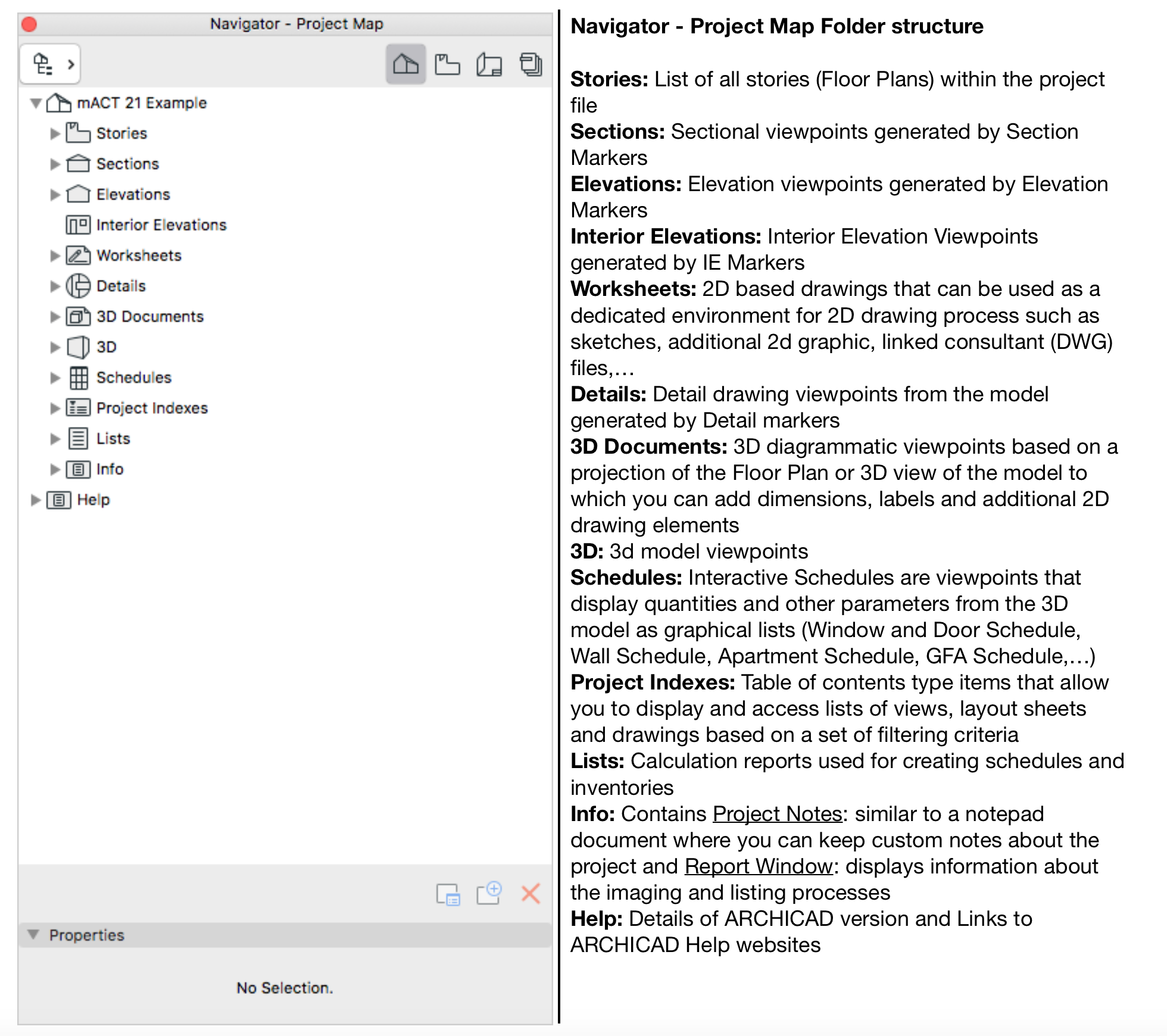
This is what the Project Map does. It provides a tree structure of all viewpoints of your Virtual Building Model organised into corresponding folders. Each viewpoint is a drawing or schedule/list projected straight from the virtual building model. Every time you add a storey, section or elevation marker, detail marker, schedule, a corresponding entry will be filed under the relevant category in the Project Map (refer image below).
All of the listed viewpoints (projections) of the virtual model are displaying project elements filtered through various filters, enabling the specific display of only a certain amount of elements/information that is required on a conventional drawing based on its design stage.
TIP > The basic principle is properly model elements only once, then apply filters to control its display as required.
INFO > In the Project Map the filters are shown temporarily, i.e. they are not saved.
Pros:
Navigate your way through every aspect of your project.
Cons:
Be careful although this list indicates which drawing is currently active, it does not change your view settings.
This means that there is a chance you will be drawing in the wrong layers, have essential layers turned off, work in the wrong model view (e.g. RCP vs plan), all making it more likely to have surprises when it comes to printing!
macinteract Pty. Ltd. | ABN 44 155 154 653 | terms and legal. | © 2026
We use cookies to keep things running smoothly and help us improve—no secrets here!
Please select which cookies we can use. You can change your mind whenever you like!
Websites store cookies to enhance functionality and personalise your experience. You can manage your preferences, but blocking some cookies may impact site performance and services.
Essential cookies enable basic functions and are necessary for the proper function of the website.
These cookies are used for managing login functionality on this website.
Statistics cookies collect information anonymously. This information helps us understand how visitors use our website.
Google Analytics is a powerful tool that tracks and analyzes website traffic for informed marketing decisions.
Service URL: policies.google.com (opens in a new window)